Feeds:
Posts
Comments

Posts Tagged ‘CERN’

Another earthquake has victimized Italy. Was it a natural occurrence?  Could the earthquake have been caused by some manmade scientific experiment? We are not the only one’s pointing out the unusualness of this particular earthquake.  From Discovery News-

A strong and unusually shallow earthquake struck northern Italy over the weekend, fracturing pavement, sending torrents of brick and rubble raining down from buildings, and killing seven people. The powerful shaking was a first for the region in centuries — and fairly surprising to seismologists. Data indicate the magnitude 6.0 quake, which struck just after 4 a.m. local time on Sunday (May 20), just north of Bologna, was a thrust quake — the type of earthquake caused when two tectonic plates smash together — yet it occurred at a depth of just 3 miles (5 kilometers).

“It is kind of surprising that it’s that shallow, because it’s pretty far from the plate boundary,” said Paul Caruso, a geophysicist with the U.S. Geological Survey. “Normally we expect things to get deeper as they move northward,” he told OurAmazingPlanet.

Well you know what else is shallow that runs from the town of  l’Aquila, east of Rome in the beautiful mountainous Abruzzi region in Italy, home of the San Grasso National Laboratory, all the way to CERN in Sweden?

PROJECT OPERA and A NEUTRINO BEAM!

The quake hit about 470 miles (750 km) north of the plate boundary — the place where the two colliding plates meet — which runs along the sole of Italy’s “boot.”

According to OPERA the beam runs approximately 11.5 km underground and by the looks of things pretty damned close to the epicenter near Bologna, Italy.  The Large Hadron Collider goes on and off as do many neutrino and lab experiments.  We just wonder what may have been operating on May 20, 2012?

HAARP has been jumping like it a flea on a camel’s ass lately.  Here is what came up for the search of May 20, 2012.

The next day, May 21, 2012 about 10 miles away was another earthquake. 4.5M and  little deeper at  http://earthquake.usgs.gov/earthquakes/eventpage/usb0009uhq#summary 

You might enjoy these related articles by Ahrcanum.

Italy Earthquake Epicenter Near Nuclear Physics Lab April 6, 2009 https://ahrcanum.wordpress.com/2009/04/06/italy-earthquake-epicenter-near-nuclear-physics-lab/

Italy Earthquake Conspiracy April 7, 2009. https://ahrcanum.wordpress.com/2009/04/07/italy-earthquake-conspiracy/

Sources-

http://news.discovery.com/earth/italy-quake-ferrara-shallow-far-from-plate-120522.html

http://www.lngs.infn.it/lngs_infn/index.htm?mainRecord=

http://operaweb.lngs.infn.it/spip.php?rubrique41 

Stay tuned and have a good day, one day it will be your last.  God Bless.

  flag tounge

Open wide, say ahhh and check out more posts from Ahrcanum!

The Swine Flu Report that began in April 2009 is at https://ahrcanum.wordpress.com/swine-flu-report

Shaking, rattling and rolling into the conspiracy, truth and science of EARTHQUAKES, HAARP, EISCAT, Tesla, etc., with more posts at https://ahrcanum.wordpress.com/earthquakes-haarp/

Help spread the word.  SUBSCRIBE NOW and Follow us on Twitter @ahrcanum or sign up at http://www.twitter.com/ so you can get the latest updates as soon as they’re posted. Make sure to re-tweet, so all your friends get the heads up too.

Read Full Post »

What’s twisting our antenna tonight,

Tuesday, December 6, 2011?

UFO?  NASA GOES satellite catches photo of unknown object in Earth Atmosphere.  

WordPress and YouTube do not seem to be in communication anymore thanks to the Google update.  You’ve got to click the link directly to see, well- something over the ocean between California and Japan.

http://www.youtube.com/watch?v=_2oslTvDwaQ

The message of something being out there gets lost until you see the images for yourself.

December 4, 2011 when all is fairly normal…

1112040845G13_color.jpg 04-Dec-2011 07:22 107K

And at a few short hours later, we want to know what is a triangle doing on our coast?

1112041145G13_color.jpg 04-Dec-2011 10:49 125K

What in the Sam Hell is that triangle thingy ma bopper?  Is it coming or going?  Up or Down?  The images come from reliable NASA GOES Satellite.  http://goes.gsfc.nasa.gov/goeseast/fulldisk/3band_color/  This is NASA folks, the most reliable scientists going!

Could it be  from Fukushima?  A giant amount of super heated particles damaging the ozone layer?  Is that why HAARP picked up absolutely NOTHING?  That is one heck of an entry for Phobos-Grunt. Not.

You can connect a few HAARP and EISCAT dots- possibly heating the ionosphere here- https://ahrcanum.wordpress.com/2010/01/14/haiti-earthquake-conspiracy-haarp-eiscat/

 Even The HAARP Magnetometer is quiet-

magnetometer plot...
Ending Date: (YYYYMMDD)

There are are whole bunch of other Satellites checking on our blue marble.  Maybe someone else has time to search the databases for oddities on December 4, 2011.?.

Sensors

…and more at http://visibleearth.nasa.gov/

Did GOES just catch a simple Aurora?

Aurora Over Antarctica

Hmmm, a triangular aurora?  An piece of debris on the lens?  Some kind of data corruption?  Moon dust?  Martians landing? Martians taking off?

   
Strange Image of Earth.

Whatever that thing is, it appears to be  HUGE.
MAP  2.5 2011/12/04 12:30:29   38.051  -118.873 6.1  CENTRAL CALIFORNIA
MAP  2.5 2011/12/04 12:03:12   61.491  -149.889 32.2  SOUTHERN ALASKA
MAP  2.5 2011/12/04 11:16:51   51.433  -173.768 26.1  ANDREANOF ISLANDS, ALEUTIAN IS., ALASKA
MAP  4.9   2011/12/04 10:44:36   19.905   -45.777 9.9  NORTHERN MID-ATLANTIC RIDGE
MAP  5.2   2011/12/04 10:23:54   19.815   -45.734 10.0  NORTHERN MID-ATLANTIC RIDGE
MAP  4.8   2011/12/04 10:13:04   24.659   122.111 70.6  TAIWAN REGION
MAP  4.7   2011/12/04 09:46:19  -37.827  -179.677 33.1  EAST OF THE NORTH ISLAND, NEW ZEALAND
MAP  2.7 2011/12/04 09:45:26   38.751  -122.699 1.7  NORTHERN CALIFORNIA
Maybe it is God.  Maybe it’s the Devil. Maybe it just stinks that we’ll probably never know. Then again, maybe it’s CERN.
The tunnel – to the final answer?H/T @ADG_UK on Twitter.

Stay tuned and have a good day; one day it will be your last.  God Bless.

  flag tounge

Open wide, say ahhh and check out more posts from Ahrcanum!

The Swine Flu Report that began in April 2009 is at https://ahrcanum.wordpress.com/swine-flu-report

Shaking, rattling and rolling into the conspiracy, truth and science of EARTHQUAKES, HAARP, EISCAT, Tesla, etc., with more posts at https://ahrcanum.wordpress.com/earthquakes-haarp/

Help spread the word.  SUBSCRIBE  NOW and Follow us on Twitter or sign up at http://twitter.com/ so you can get the latest updates as soon as they’re posted. Make sure to re-tweet, so all your friends get the heads up too.

Read Full Post »

Is Judgement Day, Doomsday and The Apocalypse upon us in the immediate future?  Your invited to pull out your tin foil conspiracy hat now.

The next two weeks offer a bunch of theories on the coming end of man kind and radical destruction of cities by earthquakes and natural disasters.  If the previous huge earthquakes around the world are any indicator, one might think so. 

In Rome, Italy people are taking the day off with a little bit of panic as rumors that self-taught seismologist Rafael Bendandi, who died in 1979, predicted a devastating earthquake would hit the city on May 11, 2011. Bendandi made his calculations on the basis of the movements of the planets, the moon and the sun. http://www.novinite.com/view_news.php?id=128127

Ironically enough, the planets are in alignment today.  Visit www.spaceweather.com for more.  There is also some amazing video of CME’s which have been known to disrupt the Earth’s magnetosphere additionally raising the possibility earthquakes.

Italy is no stranger to terrimoto predictions. 100′s of people in the province of L’Aquila, a 80 miles (130 km) east of Rome, were crushed in their beds when the earthquake struck March 2009.  Giampaolo Guiliani, a seismologist at the nearby Gran Sasso National Laboratory in Abruzzo predicted it.  More at https://ahrcanum.wordpress.com/2009/04/08/italy-earthquake-warnings-by-giampaolo-guiliani-dismissed/ 

Additionally we question what experiments CERN (Full list here http://greybook.cern.ch/programmes/EXP_NAM.html may have been running to perhaps cause a quake in this article, https://ahrcanum.wordpress.com/2009/04/06/italy-earthquake-epicenter-near-nuclear-physics-lab/ 

Less than two weeks ago:

The world’s biggest atom smasher has set a new world record for beam intensity, a key measure of performance and power, the European Organisation for Nuclear Research (CERN) said Friday. http://www.google.com/hostednews/afp/article/ALeqM5ijRsYCWoEnwhzIWmNT0wG5C-xfuw?docId=CNG.d329a1dc93deefddd40e90d8a495c742.311

A graphic shows the Large Hadron Collider accelerating to energy levels that had never been previously reached

Putting aside physics there is always a turn to HAARP, frequently scrutinized for causing earthquakes. The most recent great Japan Quake Conspiracy can be read here https://ahrcanum.wordpress.com/2011/03/14/japan-conspiracy-2011-earthquake-tsunami-march-14/.

In February, 2010 both Chile and Japan reported massive earthquakes at 8.8 and 7.0 Magnitudes.  Were there warning signs?  Follow the conspiracy of them at https://ahrcanum.wordpress.com/2010/02/27/chile-japan-earthquake-conspiracy/

Lest we not forget, though many have, the massive Haiti Earthquake.  Read more connections on the  Haiti Earthquake Conspiracy, HAARP, EISCAT Experiments on January 12, 2010 here https://ahrcanum.wordpress.com/2010/01/14/haiti-earthquake-conspiracy-haarp-eiscat/

Getting back to the immediate future, along comes Family Radio http://www.familyradio.com/index2.html, proclaiming:

THE END OF THE WORLD IS ALMOST HERE!
HOLY GOD WILL BRING JUDGMENT DAY ON
MAY 21, 2011

Has God sent the, “Gospel of The Kingdom” to Harold Camping and his flock  to spread the warnings of Judgement Day?  God willing, we will all be here for at least the next 10 days to see the outcome of this.  In the meantime, Family Radio continues to accept donations on-line.  You know you can’t take it with you. 

Via http://bible.cc/matthew/7-15.htm

Beware of the false prophets, who come to you in sheep’s clothing, but inwardly are ravenous wolves. Matthew 7:15

For false Christs and false prophets will appear and perform great signs and miracles to deceive even the elect–if that were possible. Matthew 24:24

Wonder what the global warming alarmists might have to say about, This is what the LORD says: “See how the waters are rising in the north; they will become an overflowing torrent. They will overflow the land and everything in it, the towns and those who live in them. The people will cry out; all who dwell in the land will wail.”   

 
Memphis in the grip of a historic 75-year flood of the Mississippi River 10 May 2011.

The Freedom From Religion Foundation  http://ffrf.org/ folks, quote Epicurus, Greek philosopher, circa 300 B.C.

Either God wants to abolish evil and cannot, or he can but does not want to.
If he wants to but cannot he is impotent. If he can but does not want to, he is wicked. If he neither can nor wants to, then he is both powerless and wicked. (via http://groups.google.com/group/alt.conspiracy/msg/0793bb49d2d75cec

What is wicked is if mankind intentionally created earthquakes and so called, weather and natural disasters.  That, you have to judge for yourself.  

Latest Earthquakes Magnitude 2.5 or Greater in the United States and Adjacent Areas and Magnitude 4.5 or Greater in the Rest of the World – Last 7 days at, http://earthquake.usgs.gov/earthquakes/recenteqsww/Quakes/quakes_all.php

If today or May 21, 2011 is the end then so much for 2012, Planet X, Nibiro, Nostradamus, Ahrcanum, etc.?  A nice wrap of conspiracies can be found by John Hogue bio. Author of 17 books in 19 languages, “Rogue” scholar, world authority on Nostradamus and the prophetic traditions of the world- http://hogueprophecy.com/

What we know for sure is that it is 80 degrees and the land needs to be tilled for this year crops- which we fully anticipate eating.  All together now say, “I will not waste today.”  Someday it will in fact, be your last day.

Stay tuned…

  flag tounge 

Open wide, say ahhh and check out more posts from Ahrcanum! 

Our Swine Flu Report that began in April is at https://ahrcanum.wordpress.com/swine-flu-report     

Shaking, rattling and rolling into the conspiracy, truth and science of EARTHQUAKES, HAARP, EISCAT, Tesla, etc., with more posts at https://ahrcanum.wordpress.com/earthquakes-haarp/  

Help spread the word.  SUBSCRIBE  NOW and Follow us on Twitter (by clicking in the side margin)  so you can get the latest updates as soon as they’re posted. Make sure to retweet, so all your friends get the heads up too.

Read Full Post »

 
Japan Earthquake
Watching the earthquakes in Japan and following tsunami happen in near real time was to say the least, heart wrenching.  Further threats from aftershocks, nuclear power plant  meltdowns, radiation poisoning, poor weather conditions, power outages, and a lack of basic supplies only compound the magnitude of the crisis.  Throw in a volcanic eruption for measure in Japan at-http://www.timeslive.co.za/world/article965229.ece/Japanese-volcano-erupts
More than 200 magnitude 5 (and above) aftershocks have been recorded in Japan since the first quake on Friday.
Frequent readers at Ahrcanum (hint, hint, subscribe in the sidebar for updates or follow us on twitter) know that we’ve written about numerous catastrophic events with a conspiracy twist.  Last year in 2010, both Chile and Japan were hit with large quakes that raised our antennae to the possibility that these events may have been caused by man. https://ahrcanum.wordpress.com/2010/02/27/chile-japan-earthquake-conspiracy/ The last 9M quake that we recall, was the 9.1M quake off the coast of Sumatra in 2004 that killed and estimated 228,000 people.

It has taken us days to absorb the magnitude of another 9.0M earthquake.  What more could we say that others have expressed so eloquently?  As reports began with a 100 dead, we immediately knew these numbers were destined to rise with new reports nearing 10,000 people dead and bodies lining shorelines and buried in the mud. 

Were there warnings by nature across the globe that went unheeded? http://au.news.yahoo.com/thewest/a/-/offbeat/9000351/tsunami-linked-to-fishy-phenomenon/ reported of huge schools of fish being so close to shore that fisherman were out with buckets in Acapulco about the same time as the earthquake hit in Japan. 

A couple troll their little boat through a mass of dead fish in the King Harbor Marina.

Just days before, millions of anchovie were found dead with reports of  fish kills in California, dead seals New Jersey and dead dolphins along the Gulf Coast. Previously reviewed in this article at https://ahrcanum.wordpress.com/2011/01/05/birds-falling-from-sky-%e2%80%93-blame-haarp-flu-poison-or-climate-change/

The cause of the die-off is nearly always decaying algae. Although the oceans are awash in algae, these microscopic organisms bloom when fed by nutrients such as fertilizers and human and animal waste washing off the land. Stoked by such nutrients and exposed to sunlight, algae flourish and then die and sink to the bottom. Bacteria then take over, breaking down the plant matter and sucking the oxygen out of seawater. That leaves little or none for fish and other marine life.  http://latimesblogs.latimes.com/lanow/2011/03/redondo-beach-dead-fish-oxygen-levels-zero.html

One commentator, Kevin on the article wrote:

Earth is undergoing a magnetic reversal. Fish use magnetic polaraty to navigate like a GPS system. No red tide caused them in here. A magnetic anomaly did. They swam against the wall agressivly and with out end till they died off from cardiac arrest.

A magnetic anomaly?  Decaying algae?  Hummm.  There were rumors of another wormhole sort of blue spiral over Russia just days before on, March 10, 2011. The video is located at http://www.youtube.com/watch?v=aV46DnxlBGs&feature=player_embedded#at=71 A test practice for the capabilities of HAARP?

Could HAARP truly unleash the power to create an underground tectonic plate shift that resulted in Japan moving 2.4 meters, according to http://au.news.yahoo.com/thewest/a/-/breaking/9002233/quake-moves-japan-2-4m/

www.notanotherconspiracy.com has done our homework for us by posting the magnometer readings from Alaska, (which is in part a joint consortium with Japan) during the time of the earthquake. Obviously the charts reflect some increase as expected.  The question lurks if an array can cause enough heating of the magnetosphere to not only record an event but, perhaps cause an event?

The Atlantean Conspiracy http://www.atlanteanconspiracy.com/2011/03/japan-tsunami-caused-by-haarp.html  points out that HAARP was basically flatlined in the days before the quake.  Coincidence?

And, what was CERN up to? http://greybook.cern.ch/programmes/EXP_NAM.html A whole lot of particles on any given day that just happened to restart, “at the weekend,” according to http://www.reuters.com/article/2011/03/14/us-science-cern-idUSTRE72D5DR20110314.  Another hummm?

“We can not rule out the possibility of an explosion”, said Chief cabinet Secretary Yukio Edano on Sunday regarding Unit 3 of the Fukushima Dai-ichi nuclear complex.  Unit 1 exploded Saturday resulting in tens of thousands, if not hundreds of thousands of people evacuating the area. Today, Monday March 14, 2011 there are reports if addional explosions at Unit 3 and reports of radiation contamination.

Efforts that amount to a Hail Mary Pass might as well turn to only saying  Hail Mary prayers for the people of Japan and what effects a nuclear release of radiation will have; wherever the clouds may blow.  If you do not think those clouds from Japan can and will blow over the U.S.A., you are sadly mistaken. 

As for Coronal Mass Ejections- we have seen our fair share as of late, but really nothing that should trip this kind of trigger.  But, Piers Morgan with Info Wars affiliation says the massive earthquake and tsunami were triggered by massive events on the sun and that there are more to come in the next two years.

So we may glance at the moon and its predictions this week of super powers from a supermoon.  This week, March 19 will bring a full moon that will bring perigee when the moon is closest to the Earth. http://www.huliq.com/10557/scientists-say-supermoon-had-no-role-japan-tsunami Will we see more earthquakes, additional volcanic eruptions?

An earthquake can move the earth’s axis and change the length of the time of day and shift the alignment of the poles according to NASA at, http://www.nasa.gov/home/hqnews/2005/jan/HQ_05011_earthquake.html.  The inertia of a predicted pole shift anticipated for 2012 is significantly twisting our antennae as well.

Is The Great Japanese Earthquake the beginning of the end for the 3rd largest economy in the world?  A sign of things to come? A sign of things ending? Recent reports are of 965 micro sieverts have been measured in the area surrounding the latest nuclear plant explosion with the mayor saying Tokyo has now started monitoring radiation.  This is the same, “Tokyo mayor Ishihara alleges tsunami is “heavenly retribution for Japan’s greed.”

What words could we write to say how insensitive Ishihara’s statement is, and that you Sir are an ass? 

Just how long until the California coastline is affected?  Stay tuned. 

Follow:

Earthquakes in Japanese http://typhoon.yahoo.co.jp/weather/jp/earthquake/ 

USGS a quake list for 10 -degree map centered at 35N, 140E, the Honshu Region- http://earthquake.usgs.gov/earthquakes/recenteqsww/Maps/10/140_35.php 

Live UStream TV Japan http://www.ustream.tv/channel/nhk-gtv

Aljazeera TV in English at   http://english.aljazeera.net/watch_now/

Top of Page, Japan earthquake image credits to http://www.allvoices.com/cartoons/c/75086966-Japan-Earthquake#parent_comment_div


 flag tounge      

Open wide, say ahhh and check out more posts from Ahrcanum!   

Shaking, rattling and rolling into the conspiracy, truth and science of EARTHQUAKES, HAARP, EISCAT, Tesla, etc., with more posts at https://ahrcanum.wordpress.com/earthquakes-haarp/       

Help spread the word.  SUBSCRIBE  NOW and Follow us on Twitter (by clicking in the side margin) or sign up at http://twitter.com/ so you can get the latest updates as soon as they’re posted. Make sure to re-tweet, so all your friends get the heads up too.         

 CITE THIS SOURCE or may the fleas of  a thousand camels infest your armpits.

Read Full Post »

Earthquakes are slamming Alaska today as the Solar Storm continues to pummel the earth with geomagnetic activity. 

This morning a Magnitude 6.3 Earthquake struck the  ANDREANOF ISLANDS, ALEUTIAN IS., ALASKA. at 2010 August 04 12:58:24 UTC http://earthquake.usgs.gov/earthquakes/recenteqsww/Quakes/us2010znbf.php

6.3M is nothing to shake a stick at. 

HAARP’s magnetometers were fairly calm until the start of the solar storm, kicked off by Sunspot 1052.  It is now picking up significant anomalies in the magnetosphere.  The three traces represent mutually orthogonal components of the earth’s magnetic field as follows:

  • The “H” component (black trace) is positive magnetic northward
  • The “D” component (red trace) is positive eastward
  • The “Z” component (blue trace) is positive downward

HAARP Magnetometer Chain

Real-time monitoring of the Earth’s magnetic field, Data for research and practical application from USGS  is showing major spikes from Alaska all the way to Guam. You can view the real time data at  http://geomag.usgs.gov/realtime/, which supposedly demonstrates a wide dispersal of geomagnetic energy affecting far apart distances. 

As we grab for our tinfoil hat, the Station- CMO Fairbanks, AK, located at 25.13°/212.14° at 197 meters, went OFFLINE BEFORE the quake hit.  It was picked up at almost all reporting stations including as far as the station at SJG, Cayey, PR,71.89°/293.85°, 424 meters.

Scientifically,we are under a solar storm alert, all be it, a supposed minor one.   http://www.swpc.noaa.gov/SWN/index.html NOAA Alerts / Bulletins
Latest Alert: Aug 04 1032 UTC ALERT: Geomagnetic K-index of 5.  Yesterday in was an index of 4. 

Latest GOES Solar X-ray Image, 2010 Aug 04 15:25 UTC (Aug 04 09:25 MDT)

Spacequakes have been going on for sometime in our universe, but now we have a model prediction thanks to the satellites circling the Sun. 

In 2007, THEMIS discovered the precursors of spacequakes. The action begins in Earth’s magnetic tail, which is stretched out like a windsock by the million-miles-per-hour solar wind. Sometimes the tail can become so stretched and tension-filled, it snaps back like an over-torqued rubber band.

Solar wind plasma trapped in the tail hurtles toward Earth. On more than one occasion, the five THEMIS spacecraft were in the line of fire when these “plasma jets” swept by. Clearly, the jets were going to hit Earth. But what would happen then? The fleet moved closer to the planet to find out.

“Now we know,” said THEMIS project scientist David Sibeck of NASA’s Goddard Space Flight Center in Greenbelt, Md. “Plasma jets trigger spacequakes.”

According to THEMIS, the jets crash into the geomagnetic field some 18,600 miles (30,000 km) above Earth’s equator. The impact sets off a rebounding process, in which the incoming plasma actually bounces up and down on the reverberating magnetic field, akin to a tennis ball bouncing up and down on a carpeted floor. The first bounce is a big one, followed by bounces of decreasing amplitude as energy is dissipated in the carpet.  http://ca.news.yahoo.com/s/yahoocanada/100728/canada/violent_spacequakes_shake_earth_from_above

If plasma bounces up and down on the reverberating magnetic field after it crashes someplace above the equator, could it have bounced on over to Alaska to cause this earthquake and the one earlier today- Magnitude 6.4 – EASTERN NEW GUINEA REG, PAPUA NEW GUINEA,  2010 August 04 07:15:33 UTC http://earthquake.usgs.gov/earthquakes/recenteqsww/Quakes/us2010znav.php?

That’s a pretty big bounce.

If the satellites can observe CME’s from the Sun, is there nothing NASA has available to track where the plasma impact occurs on Earth? 

Could this solar alert provide a perfect covert opportunity for advanced weapons experiments using SCALAR weapons?  What are the chances that a station goes off line in the vicinity of an earthquake before one hits?  Could HAARP have fired a beam up to heat the ionosphere causing the quake?

What of Accelerator-based experiments shooting particles through the Earth? A solar storm is the perfect storm to attempt some new experiment that could cause of quakes and disruptions.

The neutrinos are generated at CERN when a proton beam from the Super Proton Synchrotron strikes a target, producing pions and kaons. These quickly decay, giving rise mainly to νμ that pass unhindered through the Earth’s crust towards Gran Sasso. The appearance and subsequent decay of a τ in the OPERA experiment would provide the telltale sign of νμ to ντ oscillation through a charged-current interaction. http://cerncourier.com/cws/article/cern/43178

Recall that the San Grasso Lab was almost ground zero for the Italy Quake!

While this solar storm seems minor, millions of people are getting there first opportunity to see the aurora borealis with a wider than normal viewing area depending on the weather

Auroral Activity Extrapolated from NOAA POES

With all that energy, could a wormhole form due to the magnetic properties of the north pole, interacting with the solar winds?  Shall we send our politicians for a look?

While Alaska and New Guinea are rattling, finally at BP at the  Deep Water Horizon Oil Spill in The Gulf of Mexico, “claimed “a significant milestone” in efforts to plug a leaking well for good on Wednesday ahead of a U.S. government report that will show most of the spilled crude is already gone.

“The good news is that the vast majority of the oil appears to be gone,” Carol Browner said on ABC’s “Good Morning America.”

 A New York Times story said the report would show three-quarters of the oil released has already evaporated, dispersed, been captured or eliminated. http://ca.news.yahoo.com/s/reuters/100804/n_top_news/cnews_us_oil_spill

This too shall pass.  Until the next disaster, earthquake, experiment, etc.

flag tounge        

Open wide, say ahhh and check out more posts from Ahrcanum!        

Help spread the word.  SUBSCRIBE NOW and Follow us on Twitter (by clicking in the side margin) or sign up at http://twitter.com/ so you can get the latest updates as soon as they’re posted. Make sure to re-tweet, so all your friends get the heads up too.        

 CITE THIS SOURCE, or may the fleas of a thousand camels infest your armpits.

Read Full Post »

As a Solar Storm is heading to Earth, the conspiracy rattles on with reports of high magnitude earthquakes and unusual Magnetometer chart readings from HAARP and USGS. 

Magnitude 5.3 – SOUTHWEST OF SUMATRA, INDONESIA 2010 August 03 08:03:18 UTC http://earthquake.usgs.gov/earthquakes/recenteqsww/Quakes/us2010zmat.php

Magnitude 5.0 – OFFSHORE TARAPACA, CHILE  2010 August 03 05:29:21 UTC http://earthquake.usgs.gov/earthquakes/recenteqsww/Quakes/us2010zmaq.php

Magnitude 6.3 – MOLUCCA SEA 2010 August 03 12:08:26 UTC http://earthquake.usgs.gov/earthquakes/recenteqsww/Quakes/us2010zma4.html

Magnitude 5.4 – TAJIKISTAN 2010 August 03 16:26:27 UTC http://earthquake.usgs.gov/earthquakes/recenteqsww/Quakes/us2010zmbf.php

Yadda, yadda.  There are earthquakes everyday, but it is not everyday that the Sun hurls giant Coronal Mass Ejections towards the Earth’s magnetosphere.  On August 1st, a flare, shockwave, filament eruption and CME erupted on the Earth-facing side of the sun.  The CME is heading directly for us — see the SOHO video of the CME.  The storms arrival time? August 3rd, 2010, TODAY.

Solar Sunspot 1092. Image: Oleg Toumilovitch, July 31st, rising over Blairgowrie, South Africa.

NASA’s Solar Dynamics Observatory (SDO) and the NASA/ESA Solar and Heliospheric Observatory (SOHO) detected the C3-class solar flare, sunspot #1092.

After sunset,  look west and you will see Venus, Saturn, and Mars have converged to form a triangle.  You will also see the Summer Triangle – technically an asterism, rather than a constellation – formed by the stars Vega, Altair and Deneb.  (https://ahrcanum.wordpress.com/2010/08/01/illuminati-triangle-in-the-sky/)  

Scientists said residents of northern regions — possibly including Seattle, as well as parts of Michigan and Maine — may see an unusual display of the aurora borealis, the northern lights. http://www.mercurynews.com/top-stories/ci_15661076?nclick_check=1

NOAA forecasters estimated a 10% chance of major geomagnetic storms and a 45% chance of at least some geomagnetic activity when the clouds arrive on August 3rd and 4th. via http://spaceweather.com/  Wouldn’t you like nearly 50% odds of hitting the lottery? 

Translation, we’ve got a 50% chance that we’re going to have some geomagnetic activity that may or may not cause satellite interference and communications malfunctions here on earth.   The earth, so delicately balanced also relies on the magnetosphere and ionosphere to protect it from upheaval.  NOAA / Space Weather Prediction Center reassures us all is calm, all is bright, all is all right.

Alerts / Bulletins
Latest Alert: Aug 03 1827 UTC WARNING: Geomagnetic K-index of 4 expected
Last Advisory Bulletin: None in last 7 days.

It would seem likely that if the Earth’s atmospheric magnets are going out of whack so is the Earth, and possibly the cause of an increase in earthquakes and volcanoes.

The scientists will tell you about plate tectonics causing earthquakes.  Most recently is a new theory out of  Purdue University.

Earthquakes, “came from stored stress built up in the Earth’s crust long ago…Our theory links an external climate-driven process, the melting of the ice sheet, and earthquakes…Unfortunately, this stored stress is invisible to us.” via US News & World Report Science at  http://ht.ly/18pBTL

That’s one theory.  No matter, all the Earth’s Observatories should be in ready, set, go, mode to record some impressive atmospheric activity..

We’ve asked  it time and time again if the High Frequency Active Auroral Research Project (HAARP), is a scientific advance of  knowledge or a system of destruction capable of causing earthquakes, tsunami, and otherwise “natural disasters?” https://ahrcanum.wordpress.com/2010/01/18/haiti-earthquake-conspiracy-haarp-patents-arecibo/.  What about EISCAT, SURA and the worlds other large arrays?  Do you think they only receive and not emit?

The Arecibo Observatory is the largest and most sensitive radiotelescope.  It sits atop the seismically active Puerto Rico Trench, and ever so close to Haiti.    You can download data from the Arecibo dual-frequency ASHTECH MicroZ-CGRS GPS receiver and high quality choke-ring antenna.  http://www.naic.edu/aisr/GPSTEC/gpstec.html.   Sadly, it offers no real time data and is only up to releasing the 90th day of the year’s activity. A lot of good that does for now.

What are the volcano’s doing?  The  SI / USGS Weekly Volcanic Activity Report  doesn’t come out until tomorrow.   http://www.volcano.si.edu/reports/usgs/

Real-time monitoring of the Earth’s magnetic field, Data for research and practical application from USGS main page work offering real time data and presently lots of spikes, UTC 24hr Time of last update 19:00 UTC 24hr Time.

BRW
Point Barrow, AK
18.68°/203.38°
12 meters
DED
Deadhorse, AK
19.64°/201.21°
10 meters
CMO
Fairbanks, AK
25.13°/212.14°
197 meters
SIT
Sitka, AK
32.94°/224.67°
24 meters
SHU
Sand Point, AK
34.65°/199.54°
80 meters
NEW
Newport, WA
41.73°/242.88°
770 meters
BOU
Boulder, CO
49.86°/254.76°
1682 meters
BDT
Boulder, CO
49.86°/254.76°
1682 meters
FRD
Corbin, VA
51.80°/282.63°
69 meters
FRN
O’Neals, CA
52.91°/240.28°
331 meters
TUC
Tucson, AZ
57.83°/249.27°
946 meters
BSL
Stennis, MS
59.65°/270.37°
8 meters
HON
Ewa Beach, HI
68.68°/ 202.00°
4 meters
SJG
Cayey, PR
71.89°/293.85°
424 meters
GUA
Dededo, Guam
76.41°/144.87°
140 meters

Would ya look at those Spikes in the last hour or so!  The impressive thing is that the spikes are being picked up at ALL of the Stations.  http://geomag.usgs.gov/realtime/

Let’s have a look at what our tax dollars are buying at HAARP.

HAARP Fluxgate Magnetometer, August 3, 2010.

The chart above is a running 36 hour plot of the readings taken from the fluxgate magnetometer, built by the University of Alaska, Geophysical Institute, operating at the HAARP ionospheric observatory in Gakona, Alaska. The three traces represent mutually orthogonal components of the earth’s magnetic field as follows:

  • The “H” component (black trace) is positive magnetic northward
  • The “D” component (red trace) is positive eastward
  • The “Z” component (blue trace) is positive downward

Hmmm, looks like a split in the road between the red and the black.  We have never seen such an anomaly at the same time.  There is only one positive North.  Here something is creating two positives at the same time.

Is that possible?  We are positively confused.

More confusing, shortly after uploading these graphs, lo and behold, another earthquake. http://earthquake.usgs.gov/earthquakes/recenteqsww/Quakes/us2010zmby.php

MAP  5.4   2010/08/03 19:42:14    -9.452    39.066  10.0   TANZANIA

#####

Open wide, say ahhh and check out more posts from Ahrcanum!        

Help spread the word.  SUBSCRIBE NOW and Follow us on Twitter (by clicking in the side margin) or sign up at http://twitter.com/ so you can get the latest updates as soon as they’re posted. Make sure to re-tweet, so all your friends get the heads up too.        

 CITE THIS SOURCE, or may the fleas of a thousand camels infest your armpits. 

Read Full Post »

Is the earth sinking in on itself? 

While it appears that our economy is in a deflationary sinkhole, numerous sinkholes are being reported throughout the world. Wiki says, “A sinkhole, also known as a sink, shake hole, swallow hole, swallet, doline or cenote, is a natural depression or hole in the earth’s surface caused by karst processes – the chemical dissolution of carbonate rocks.”

A natural depression? Many of the recent sinkholes occurring around the world are not in an area where there are carbonate rocks, so what’s up? Or should we ask, what’s going down?

Two new sinkholes were reported today.

HARRIMAN, Tenn. (WVLT) — State transportation officials are warning drivers to avoid a sinkhole on Interstate 40 westbound in Roane County.   TDOT says maintenance crews discovered the sinkhole Monday morning in the right-hand lane at mile marker 344.5, just past the Harriman exit. http://www.volunteertv.com/news/headlines/99242529.html?ref=529

AND

A large sinkhole caused by heavy rains last week has closed down U.S. 51 north of Janesville, and officials don’t know when the road will reopen.  The state traffic operations center said the highway was shut down as of 10:14 a.m. Monday.  Traffic is blocked in both directions, from U.S. 14, near where the sinkhole formed, north about seven miles to County M, the state Department of Transportation said. http://host.madison.com/ct/news/local/article_7da125b0-98cd-11df-beb8-001cc4c03286.html

On July 23rd, a man was rescued from a sinkhole in Milwaukee, asking “What happened?” after his Cadillac Escalade plummeted into the a chasm that opened up during a deluge. http://www.aolnews.com/nation/article/milwaukee-sinkhole-swallows-driver-in-suv/19566080

In Alabama, The Department of Transportation hopes to have a sinkhole on I-65 fixed by the end of the week. Traffic in Hoover and Pelham has been snarled for most of the month. http://www.myfoxal.com/Global/story.asp?S=12868441

On July 22, 2010 a sinkhole 45 meters deep was discovered in the Yucatan.

The giant hole in an agricultural area Chencoh , Hopelchén

The depth of the hole is estimated at more than 45 meters, the gap is 13 to 15 meters in diameter. It is the first time an event is recorded of its kind in the history of the entity and therefore the State Emergency Centre ( Cenecam ) isolated the area to prevent accidents, as they fear more landslides.

“It’s amazing , the collapse of Guatemala in June had 31 meters deep , it exceeds it , “said Mario Arcovedo of Cenecam . http://www.yucatan.com.mx/noticia.asp?cx=16$1310000000$4349232 

30m-diameter sinkhole in a northern district of Guatemala City

Mario Arcovedo of Cenecam was a bit confused.  The Guatemala sink hole was 60 meters deep, 30 meters wide, according to The Guardian.

Tropical Storm Agatha swept across Central America yesterday, bringing torrential rain that killed more than 100 people and opened a 60m-deep sinkhole in Guatemala City. http://www.guardian.co.uk/world/2010/jun/01/storm-agatha-hole-guatemala

We wrote on the Guatemala hole in this article- https://ahrcanum.wordpress.com/2010/06/01/conspiracy-hurricane-volcano-fema-oil/  stating , “That’s some perfectly round sinkhole, wouldn’t you say?  Almost looks as if it was man-made.”

“With few exceptions, the ground collapses that constitute the karst geohazard in engineering activity in limestone terrains are induced by human activity,” says the Quarterly Journal of Engineering Geology and Hydrogeology; 2008; v. 41; issue.3; p. 291-300. http://qjegh.lyellcollection.org/cgi/content/abstract/41/3/291

What if that human activity extends beyond uncontrolled surface drainage, bad engineering, and poor geology?  Alabama Department of Transportation spokesman Tony Harris said Friday sinkholes remain a problem for North Alabama with limestone deposits. Blame that one on geology, as for the rest?

What if it extends to the human activity behind projects like HAARP, CERN, FERMI, DARPA (Defense Advanced Research Projects Agency) and other conspiratorial projects? Project Blue Beam, part one?

Rainfall amounts ranging from 5-20 inches is not normal in the Midwest or the DC area.  It feeling a bit like the the Amazon! Shall we believe nature is showing a supernatural course around the world?  Are you more akin to believe it is weather modification?

And, if you don’t believe in weather modification:

“Others [terrorists] are engaging even in an eco-type of terrorism whereby they can alter the climate, set off earthquakes, volcanoes remotely through the use of electromagnetic waves… So there are plenty of ingenious minds out there that are at work finding ways in which they can wreak terror upon other nations…It’s real, and that’s the reason why we have to intensify our [counterterrorism] efforts.” Secretary of Defense William Cohen at an April 1997 counterterrorism conference sponsored by former Senator Sam Nunn.  http://weatherwars.info

Sounding like a military operation, the Chinese government authorized the use of 1,104 cloud seeding missile launches from 4:00-11:39pm on Friday night to remove the threat of rain ahead of the 29th Olympic opening ceremony in Beijing.

We fired a total of 1,104 rain dispersal rockets from 21 sites in the city between 4 p.m. and 11:39 p.m. on Friday, which successfully intercepted a stretch of rain belt from moving towards the stadium” – Guo Hu, Beijing Municipal Meteorological Bureau (BMB). http://www.universetoday.com/2008/08/12/the-chinese-weather-manipulation-missile-olympics/

FOR SALE, Bulgaria Weather Modification Cloud Seeding Rocket Loza

Maybe they should be using those dispersal rockets now.  Leave it to China to broker the sale of a Bulgaria Weather Modification Cloud Seeding Rocket Loza.

Heavy rains, flooding and disasters have killed at least 742 people and left hundreds more missing this year across much of China, state-run media reported on Monday.  Rains have affected nearly 36 million people and more than one million have been relocated.  Floods and landslides have killed dozens more people in recent days and forced the evacuation of another 12,000 people in western and central China….Although floods are common in China during the wet season, floods this year have been the worst in decades.  http://english.ntdtv.com/ntdtv_en/ns_china/2010-07-26/930104913328.html
   
China, Russia, the U.S. and others have admitted to controversial weather modification programs. Static Brain wrote at, http://www.staticbrain.com/archive/haarp-weather-modification-for-weather-warfare/

As if electromagnetic pulses in the sky and mental disruption were not enough, Bernard J. Eastlund (patent holder and developer of some of the HAARP technology, bragged that the super-powerful ionospheric heater could control weather. Begich and Manning brought to light government documents indicating that the military has weather-control technology. When HAARP is eventually built to its full power level, it could create weather effects over entire hemispheres. If one government experiments with the world’s weather patterns, what is done in one place will impact everyone else on the planet.

A research paper entitled, Weather as a Force Multiplier: Owning the Weather in 2025 , submitted in 1996-http://www.fas.org/spp/military/docops/usaf/2025/v3c15/v3c15-1.htm stating that:

In 2025, US aerospace forces can “own the weather” by capitalizing on emerging technologies and focusing development of those technologies to war-fighting applications

Table 1 – Operational Capabilities Matrix

DEGRADE ENEMY FORCES ENHANCE FRIENDLY FORCES
Precipitation Enhancement Precipitation Avoidance
– Flood Lines of Communication – Maintain/Improve LOC
– Reduce PGM/Recce Effectiveness – Maintain Visibility
– Decrease Comfort Level/Morale – Maintain Comfort Level/Morale
Storm Enhancement Storm Modification
– Deny Operations – Choose Battlespace Environment
Precipitation Denial Space Weather
– Deny Fresh Water – Improve Communication Reliability
— Induce Drought – Intercept Enemy Transmissions
Space Weather – Revitalize Space Assets
– Disrupt Communications/Radar Fog and Cloud Generation
– Disable/Destroy Space Assets – Increase Concealment
Fog and Cloud Removal Fog and Cloud Removal
– Deny Concealment – Maintain Airfield Operations
– Increase Vulnerability to PGM/Recce – Enhance PGM Effectiveness
Detect Hostile Weather Activities Defend against Enemy Capabilities

Just makes you want to sing, “It’s raining, it’s pooring…,” but no man should be snoring.  Wake up before you sink further into believing that these things aren’t possible. 

It was after all rather convenient that another tropical storm evaded the BP oil spill disaster.  A significant amount of air space remains closed over the Gulf spill. https://ahrcanum.wordpress.com/2010/06/16/faa-closes-airspace-gulf-oil-spill/

I wonder how the mystery tests are coming along with DARPA’s X-37B?

The X-37B Orbital Test Vehicle will provide a flexible space test platform to conduct various experiments and allow satellite sensors, subsystems, components and associated technology to be efficiently transported to and from the space environment where it will need to function. https://ahrcanum.wordpress.com/2010/04/22/x37b-otv-spaceplane-launch-to-militarize-space/

Video HT http://conspiracy.ifoday.com/?p=19765

flag tounge      

Open wide, say ahhh and check out more posts from Ahrcanum!      

Shaking, rattling and rolling into the conspiracy, truth and science of EARTHQUAKES,  VOLCANO’s, HAARP, EISCAT, Tesla, etc., read more posts at https://ahrcanum.wordpress.com/earthquakes-haarp/       

Help spread the word.  SUBSCRIBE NOW and Follow us on Twitter (by clicking in the side margin) or sign up at http://twitter.com/ so you can get the latest updates as soon as they’re posted. Make sure to re-tweet, so all your friends get the heads up too.      

 CITE THIS SOURCE, or may the fleas of a thousand camels infest your armpits.

Read Full Post »

A sinkhole that swallowed a three-storey building in Guatemala City has been blamed on a combination of Tropical Storm Agatha and poor drainage systems. Photograph: Luis Echeverria/AP

Hurricane season officially begins today, and not a moment too soon with a tropical storm brewing in the Gulf of Mexico.

An “active to extremely active” hurricane season is expected for the Atlantic Basin this year according to the seasonal outlook issued by NOAA’s Climate Prediction Center – a division of the National Weather Service. via http://www.noaanews.noaa.gov/stories2010/20100527_hurricaneoutlook.html

Tropical Storm Agatha swept across Central America yesterday, bringing torrential rain that killed more than 100 people and opened a 60m-deep sinkhole in Guatemala City which reportedly swallowed up a three-storey building. The first named storm of the 2010 Pacific season dumped more than a metre of rain in parts of Guatemala, also hitting El Salvador and Honduras. Reports http://www.guardian.co.uk/world/2010/jun/01/storm-agatha-hole-guatemala

That’s some perfectly round sinkhole, wouldn’t you say?  Almost looks as if it was man-made.  Maybe it was just another HAARP or a Blue Beam demonstration? 15 of the World’s largest holes can be viewed at http://www.ebaumsworld.com/pictures/view/175284/

When Tropical Storm Agatha gets into the Gulf it will be renamed Alex, where it will further the spread of oil leaking from the Deepwater Horizon Oil Spill. ht to http://monkeyfister.blogspot.com/2010/05/tropical-depression-agatha-crossing.html  A hurricane would be one sure fired way to dispurse the oil.

Predictions for Tropical Storm Alex

On the May 28 edition of Premiere Radio Networks’ The Rush Limbaugh Show, el Rushbo eluded that the oil spill could intensify hurricanes. Media Matters http://mediamatters.org/mmtv/201005280034  has the soundbite, and at least one commentator-Gravity_78  agrees saying that:

Water (H2O) losses about 2F for every 100 ft, Sea Water losses about 1.4 F for every 100 ft. Oil on the other hand heats up under pressure, so the great the pressure the hotter the oil will be. In turn the oil could heat the waters around it by as much as 5 F, and that would be bad. Hot water is what drives a hurricane, the hotter the water the stronger the hurricane.

Even if this storm subsides, there will be another one right behind it to create an oily mess.  Here is the latest image from the GOES satellite. Additional satellite images of the Gulf here http://www.goes.noaa.gov/g8hu.html, all regions viewing at http://www.goes.noaa.gov/

A Perfect Tropical Storm Circle. June 1, 2010, GOES East Hurricane SECTOR IR Image

A perfectly round sinkhole and a perfectly round Tropical Storm?  Perfect crap.  Here is some more bull:

“If this outlook holds true, this season could be one of the more active on record,” said Jane Lubchenco, Ph.D., under secretary of commerce for oceans and atmosphere and NOAA administrator. “The greater likelihood of storms brings an increased risk of a landfall. In short, we urge everyone to be prepared.” FEMA is working across the administration and with our state and local partners to ensure we’re prepared for hurricane season,..You can’t control when a hurricane or other emergency may happen, but you can make sure you’re ready.” said FEMA Administrator Craig Fugate.

Well that’s just phooey.  No one was ready for the damage being caused by the oil spill in the Gulf- not BP, Transocean, Halliburton and especially no one in the government including the woman that either got fired or resigned, was in control.  What was it Obama said?  I’ve been in charge since day one.  If you believe New Orleans can handle another Katrina, I have a nice island for sale for a buck in the Mariana Islands.  If you don’t beleive in weather modification:

“Others [terrorists] are engaging even in an eco-type of terrorism whereby they can alter the climate, set off earthquakes, volcanoes remotely through the use of electromagnetic waves… So there are plenty of ingenious minds out there that are at work finding ways in which they can wreak terror upon other nations…It’s real, and that’s the reason why we have to intensify our [counterterrorism] efforts.” Secretary of Defense William Cohen at an April 1997 counterterrorism conference sponsored by former Senator Sam Nunn.  http://weatherwars.info/

A few days before the underwater volcano of oil erupted, the underwater volcano Eyjafjallajokull in Iceland erupted on April 15.  Since then we’ve seen numerous volcanic eruptions increase while Eyja just mysteriously ceased erupting, even though scientists predicted it to continue for months.  https://ahrcanum.wordpress.com/2010/05/25/icelands-volcano-eruption-endstops/ Here is today’s image of the day from http://www.osei.noaa.gov/, displaying a lovely shade of blue ash from this weekends eruption in Ecuador.   

Tungurahua Volcano, May 28, 2010

This Saturday, there was a supposed an under water volcanic eruption near the Pacific’s Northern Marianas Island , 3,800 miles southwest of Hawaii that shot clouds of ash and vapor nearly eight miles into the sky. That’s 40,000 feet ladies and gents.  The U.S. Geological Survey says Saturday morning’s eruption appeared to come from an underwater volcano off Sarigan, an uninhabited island about 100 miles north of the U.S. commonwealth’s main island of Saipan.  No satellite images for that mystery event.

Sarigan Island in the northern Mariana Islands undersea eruption

What was going on at nearby andersen air force base guam, guam navy base, marine corps base guam is any one’s guess.  President Obama is scheduled to visit Guam sometime this June via http://www.digitaljournal.com/article/289451.

The Weather Service statement says that on Saturday night about 10:30pm,  the residents of Sarigan reported an eruption south of their island. [However that conflicts with a report in the Saipan Tribune http://www.saipantribune.com/newsstory.aspx?cat=1&newsID=100077  which says the eruption occurred Friday at noon.]http://www.pacificnewscenter.com/index.php?option=com_content&view=article&id=5505:cnmi-disaster-emergency-after-underwater-volcano-erupts&catid=45:guam-news&Itemid=156 Friday, Saturday, oh what’s the difference?

If a tree falls in the woods and there is no one there to hear it, does it make noise?  Who pushed the tree over?  How do you know it fell? We’ve got beam loss from CERN, the Chinese teleporting photons, submarine volcanic eruptions and thousand’s of gallons of oil spewing.  Come rain or shine, your government and FEMA stand ready to help you in the event of disasters like hurricanes, fire, or pandemic flu! Be prepared and find the FEMA camp near you at https://ahrcanum.wordpress.com/2009/05/10/fema-ready-for-flu-pandemic-fire-floods-resistance/

If there really isn’t a New World Order Conspiracy, then the chaos from the earth sure is coincidental.  Rahm Emanuel said, “You never want a serious crisis to go to waste. And what I mean by that is an opportunity to do things you think you could not do before.”

Preparedness info can be found at www.Ready.gov and www.hurricanes.gov/prepare.

flag tounge      

Open wide, say ahhh and check out more posts from Ahrcanum!      

Shaking, rattling and rolling into the conspiracy, truth and science of EARTHQUAKES,  VOLCANO’s, HAARP, EISCAT, Tesla, etc., read more posts at https://ahrcanum.wordpress.com/earthquakes-haarp/       

Help spread the word.  SUBSCRIBE NOW and Follow us on Twitter (by clicking in the side margin) or sign up at http://twitter.com/ so you can get the latest updates as soon as they’re posted. Make sure to re-tweet, so all your friends get the heads up too.      

 CITE THIS SOURCE, or may the fleas of a thousand camels infest your armpits.

Read Full Post »

Mount St. Helen's Eruption May 18, 1980. (Nat. Geo)

Mount Saint Helen’s volcano erupted thirty years ago today-May 18, 1980.  “The devastation erupted so violently that it leveled 150 square miles of trees, sent the mountain’s north face 14 miles down the Toutle River and dropped gray ash around the world.”  http://www.usatoday.com/NEWS/usaedition/2010-05-17-mtsthelens17_ST_U.htm?csp=34 

The destruction began at 8:32 a.m. on May 18, when the north side of the mountain slid away after two months of intense earthquake activity and weaker eruptions. The landslide uncorked pressurized magma and released a blast so powerful that 1,300 feet of the mountain’s peak collapsed or blew outward, 24 square miles of valley was filled by a debris avalanche, 250 square miles of land was damaged by a lateral blast, and 57 people were killed.

Iceland’s Eyjafjallajokull began the eruption in the same way, with an increase an increase of earthquake activity.  Eya continues to erupt and cause disruptions, but no one has died and the lava has not spread 150 miles of devastation.  Eya is holding us hostage,  not sending us running for cover-at least not yet.  

It is Iceland’s other major volcano’s that are becoming increasingly the center of debate.  Scientists are predicting  decades of ash disruptions and predictions of eruptions from Katla, which lies only 15 miles to the east of Eyjafjallajokull volcanic eruptions. 

Lo and behold there was a quake beneath both Hekla on May 16 and Katla, May 17. via The Ice Met Office.  Uh, oh.

An eruption at Katla would cause very sudden jökulhlaups (glacier outburst floods).  They occurred during the subglacial eruption in Eyjafjallajökull volcano but have slowed.  Katla’s ice crater is estimated to be 2,000 feet thick and if she blows, that ice is going to melt fast and quickly wiping out everything in it’s path.  It is the fourth largest volcano in Iceland -220 sq. miles (580 sq. km). A large caldera 9 miles (14 km) in diameter underlies the ice.

At least three other big Icelandic volcanoes are building towards an eruption, according to Thor Thordarson, a volcanologist at Edinburgh University.  The three other volcanoes cited by Thordarson as being potentially close to a large eruption are Grimsvotn, Hekla and Askja — all of which are bigger than Eyjafjallajokull. http://www.timesonline.co.uk/tol/news/uk/article7127706.ece

Looking ever so peaceful, is the Hekla crater in this 2008 photo by David Adamson. http://picasaweb.google.com/thunder.son Hekla is 75 miles (120 km) east of Reykjavik and last erupted in 2000.

The Institute of Earth Sciences reports, “Hekla is a volcano with special seismic characteristics. During non-eruptive periods it is virtually aseismic, and does not give any obvious long-term or intermediate-term precursory warning before eruptions. The eruption-related seismicity starts only 30-80 minutes before its onset.  http://www.earthice.hi.is/page/ies_heklaseismicity

Mount St. Helen’s and Iceland’s Eyjafjallajokull volcanic eruptions gave obvious seismic warning signs far ahead.  A quiet Hekla poses a huge challenge for predictability, warnings and safety. 

There is perhaps no other natural disaster quite as spectacular or potentially as destructive as that of an erupting volcano. Spewing out ash and magma that can kill a human in seconds, unleashing toxic gases from the belly of the planet, a volcano is truly nature’s fury unleashed. http://scrapetv.com/News/News%20Pages/usa/pages-4/Climber-unexpectedly-dies-after-falling-into-volcano-Scrape-TV-The-World-on-your-side.html

Human curiosity via webcams and tours to view volcano’s are common. Falling to your death in one is not so common. In February 2010, Joseph Bohlig posed for a picture with Mount Rainier in the background when he turned around and took a final step on the cornice and fell to his death. 

Though the connections go down pretty often, I’ll stick to the webcams at: 

 link to sv.tinypic.com]  [link to eldgos.mila.is]  [link to www.ruv.is]  [link to www.vodafone.is] [link to www.mulakot.net] [link to www.sat24.com]  “We have limited TV footage of the volcanic eruption. It’s all the same shots, and the same angles. Surely there must be something new to show? And there was a shot of a car in a dust cloud. Easily staged, and the only “evidence” of dust,” wrote  http://citizengodden.com/2010/04/16/iceland-volcanic-cloud-conspiracy/.

Putting our tinfoil hat back on, we search for any connections between natural physical science and the possibility of man causing volcano’s, earthquakes, tsunami’s and related disasters.  A cover-up of some sort?  An intervention with HAARP, ESCAT, CERN, etc., and quite possibly the impact on Earth’s magnetosphere from the atmosphere all offer some plausibility.  Others would say, God is just ticked off, that some catastrophes are just an, “Act of God.”

One thing for sure, volcano’s and magma’s muscle put humility in man and the power beneath our planet.

Watch the Mount St. Helen’s Volcano courtesy of your tax dollars at, http://www.fs.fed.us/gpnf/volcanocams/msh/.

flag tounge      

Open wide, say ahhh and check out more posts from Ahrcanum!      

Shaking, rattling and rolling into the conspiracy, truth and science of EARTHQUAKES,  VOLCANO’s, HAARP, EISCAT, Tesla, etc., read more posts at https://ahrcanum.wordpress.com/earthquakes-haarp/       

Help spread the word.  SUBSCRIBE NOW and Follow us on Twitter (by clicking in the side margin) or sign up at http://twitter.com/ so you can get the latest updates as soon as they’re posted. Make sure to re-tweet, so all your friends get the heads up too.      

 CITE THIS SOURCE or may the fleas of  a thousand camels infest your armpits.

Read Full Post »

Are the Earthquakes, Cyclones and Volcanoes that are occurring giving clue that some larger catastrophe is coming?

Conspiracies from HAARP, EISCAT, CERN’s LHC and other man-made experiments offer a plausible explanation, but certainly not a definitive one for the cause and frequency of the recent rash of disasters. 

Is Mother Nature having growing pains with theories of Tectonic Shifts, Continental Drift, the sea floor spreading;  maybe a theory of global expansion?  

Professor of Geophysics at the Nevada Seismological Laboratory, John N. Louie, Ph.D teaches, “The plates consist of an outer layer of the Earth, the lithosphere, which is cool enough to behave as a more or less rigid shell. Occasionally the hot asthenosphere of the Earth finds a weak place in the lithosphere to rise buoyantly as a plume, or hotspot.  “Only the lithosphere has the strength and the brittle behavior to fracture in an  earthquake.” http://www.seismo.unr.edu/ftp/pub/louie/class/100/plate-tectonics.html

Dr. J. Louie said, “occasionally,” yet there are daily reports of disasters from the four corners of the earth and a whole lot of places in between- most with no commonality to geography.  Some of the quakes are near tectonic plates, but not all.

IRIS Seismic Monitor

Look how far apart these large magnitude quakes have occurred!  It’s a heck of a long way from Haiti, to Chile, to Mexico to China, to Spain via  http://earthquake.usgs.gov/earthquakes/recenteqsww/Quakes/quakes_all.php: A few recent examples –

MAP  5.3   2010/04/09 16:34:26    -9.605    149.807  35.0   EASTERN NEW GUINEA REG, PAPUA NEW GUINEA
MAP  5.8   2010/04/09 22:23:00   -28.529    -68.025  87.4   LA RIOJA, ARGENTINA
MAP  5.0   2010/04/09 23:11:59    0.964    -85.338  11.6   OFF THE COAST OF ECUADOR
MAP  5.3   2010/04/10 02:53:24    -7.179    129.549  94.6   KEPULAUAN BABAR, INDONESIA
MAP  4.5   2010/04/10 09:12:28    32.671   -115.773  6.8   SOUTHERN CALIFORNIA
MAP  4.6   2010/04/10 09:47:58    61.597   -146.737  43.6   SOUTHERN ALASKA
MAP  5.9   2010/04/10 16:54:25   -20.113   -176.231  274.9   FIJI REGION
MAP  5.6   2010/04/11 04:57:29    23.257    122.056  16.7   TAIWAN REGION
MAP  6.8   2010/04/11 09:40:31   -10.913    161.130  60.2   SOLOMON ISLANDS
MAP  6.3   2010/04/11 22:08:11    37.048    -3.513  619.7   SPAIN
MAP  5.0   2010/04/12 07:57:23    76.939    18.917  10.0   SVALBARD REGION
MAP  5.7   2010/04/12 10:23:15   -56.917    147.477  22.8   WEST OF MACQUARIE ISLAND
MAP  6.9   2010/04/13 23:49:38    33.271    96.629  10.0   SOUTHERN QINGHAI, CHINA
MAP  5.0   2010/04/14 05:16:17    18.204   -101.356  71.8   GUERRERO, MEXICO

The recent earthquakes have many people feeling earthquake anxiety and wondering if they are foretelling “The Big One” in the United States, which geologists say is inevitable.

But the U.S. Geological Survey insists the number of major quakes occurring has not increased in frequency, yet people continue to be unusually concerned.  There is a widespread perception that something unusual is going on – a pervasive level of anxiety regarding the stability of the earth under our feet – something we normally take for granted. http://news.gather.com/viewArticle.action?articleId=281474978171654

Is it just pure randomness?  “In the last few years, scientists have found a new source of randomness that cannot be produced by a computer program. This is called algorithmic randomness and it is the gold standard when it comes to the absence of order.” http://www.technologyreview.com/blog/arxiv/25041/

There certainly is an absence of order on planet Earth!  There are often earthquake swarms where following one large quake, additional quakes occur as illustrated here http://fromtheold.com/news/earthquakes-today-chile-earthquake-swarm-continues-russia-and-new-guinea-has-few-earthquakes-20; they do not normally occur all over the earth.

Now we are witnessing volcanic swarms!  Thirty years ago, At 8:32 Sunday morning, May 18, 1980, Mount St. Helen’s erupted. Shaken by an earthquake measuring 5.1 on the Richter scale, the north face of this tall symmetrical mountain collapsed in a massive rock debris avalanche. Nearly 230 square miles of forest was blown down or buried beneath volcanic deposits… http://www.fs.fed.us/gpnf/mshnvm/

Ironically, there in an argument over funding for its National Monument Designation.  http://www.columbian.com/news/2010/apr/14/no-national-park-for-mount-st-helens-yet/

Now we see,

 ” A swarm of small earthquakes began Monday at a volcano near Anchorage in what scientists said was a warning that Mount Redoubt could be waking from its slumber. “It is reminding us that it is an active volcano.” said Rick Wessels, a geophysicist with the U.S. Geological Survey in Anchorage. 

Wessels said the current earthquakes were not connected to Sunday’s magnitude-7.2 quake in Mexico just south of the U.S. border. 

“We wouldn’t expect there to be any connection given the distances,” he said. http://www.google.com/hostednews/ap/article/ALeqM5j8VGiRVV36COvlIWeZk4NOj06C2wD9ET7N300

We wouldn’t expect a connection?  Except, maybe there is a connection.

The eruption of Fimmvoerduhals volcano in Iceland Photo: EPA

Thousands of miles away:

An Icelandic volcano, dormant for 200 years, has erupted, ripping a 1km-long fissure in a field of ice.  The volcano near Eyjafjallajoekull glacier began to erupt just after midnight, sending lava a hundred metres high.  http://news.bbc.co.uk/2/hi/europe/8578576.stm

Eyjafjallajokull, the Icelandic volcano that has continued to belch lava, ash and steam since first erupting last weekend, isn’t the direct problem. It’s Katla, the noisier neighbor, that’s the concern. If lava flowing from Eyjafjallajokull melts the glaciers that hold down the top of Katla, then Katla could blow its top, pumping gigantic amounts of ash into the atmosphere.

Air Travel Grounded due to Volcanic Ash

Scientists say history has proven that whenever the Eyjafjallajokull volcano erupts, Katla always follows — the only question is how soon

“When volcanic ash reaches the stratosphere, it remains for a long time,” reports Hufford. “The ash becomes a very effective block of the incoming solar radiation, thus cooling the atmosphere’s temperatures.”  http://content.usatoday.com/communities/sciencefair/post/2010/03/global-cooling-what-happens-if-the-iceland-volcano-blows/1

The Batu Tara volcano off Indonesia isn’t sleeping soundly either with the Darwin Volcanic Ash Advisory Center (VAAC) showing an ash plume rising 7,000 ft on April 5 and spreading a plume more than 35km.  

USGS offers these updates from around the world:

New Activity/Unrest: | Egon, Flores Island (Indonesia) | Etna, Sicily (Italy) | Eyjafjöll, Southern Iceland | Gaua, Banks Islands (SW Pacific) | Miyake-jima, Izu Islands (Japan) | Redoubt, Southwestern Alaska | Reventador, Ecuador
Ongoing Activity: | Arenal, Costa Rica | Batu Tara, Komba Island (Indonesia) | Dukono, Halmahera | Karymsky, Eastern Kamchatka | Kilauea, Hawaii (USA) | Kliuchevskoi, Central Kamchatka (Russia) | Popocatépetl, México | Rabaul, New Britain | Sakura-jima, Kyushu | Shiveluch, Central Kamchatka (Russia) | Soufrière Hills, Montserrat.  Updates can be found at http://www.volcano.si.edu/reports/usgs/index.cfm?wvarweek=20100407#etna

All that ash is another black mark for global warming.  Perhaps it can be washed clean with water from cyclones or hurricanes?

CALCUTTA, India (AP) — Disaster officials in India say there was no warning issued by forecasters before a cyclone struck overnight in a northeastern region. The storm’s winds topped 100 miles per hour and demolished thousands of mud homes across two states. http://www.wlos.com/template/inews_wire/wires.international/3f9eb90d-www.wlos.com.shtml

"NOAA understands and predicts changes in the Earth’s environment, from the depths of the ocean to the surface of the sun, and conserves and manages our coastal and marine resources."

NO WARNING? Whiskey Tango Foxtrot, there are buoys everywhere to set off alarm bells.  The Cyclone is one  the most famous attraction in all of Coney Island and one of the most famous roller coasters in the world, (http://www.coneyislandcyclone.com/)  Those who died and lost their homes got taken for a ride alright, especially with NOAA claiming to predict weather related disaster.

West Bengal is located at approximately, Latitude : 23° 00′ N  Longitude : 87° 00′ E.  The closet data buoy is hundreds of miles away at Station 23101
National Institute for Ocean Technology
Location:
14N 83.3E
http://www.ndbc.noaa.gov/station_page.php?station=23101  It is apparently out of order.  Could it have predicted the coming cyclone to give warning? It was supposed to. 


Relative Intensities of NOAA POES Energetic Particles

Perhaps it is the Earth’s bombardment of Energetic Particles or Space Weather causing an abundance of earthquakes, volcanoes and cyclones all on one day.  


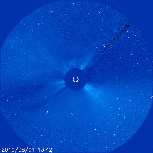
The expanding cloud could deliver a glancing blow to Earth's magnetic field around April 17th. NOAA forecasters estimate a 35% chance of polar geomagnetic activity when the CME arrives. Photo byJo Dahlmans of Ulestraten, The Netherlands.

Coincidences or not, the Earth is ticked off.  I wonder when CERN powers down if the Earth will settle down as well. 

Stay tuned.

Update.  Related post May 18, 2010 on the 30th anniversary of Mount St. Helen’s Eruption vs Iceland’s Volcano at https://ahrcanum.wordpress.com/2010/05/18/mount-st-helens-vs-iceland-volcano/

    flag tounge        

Open wide, say ahhh and check out more posts from Ahrcanum!        

Visit the Swine Flu Report beginning in April 2009 is at https://ahrcanum.wordpress.com/swine-flu-report            

Shaking, rattling and rolling into the conspiracy, truth and science of EARTHQUAKES, HAARP, EISCAT, Tesla, etc., read more posts at https://ahrcanum.wordpress.com/earthquakes-haarp/         

Help spread the word.  SUBSCRIBE  NOW and Follow us on Twitter (by clicking in the side margin) or sign up at http://twitter.com/ so you can get the latest updates as soon as they’re posted. Make sure to re-tweet, so all your friends get the heads up too.        


Read Full Post »

Older Posts »